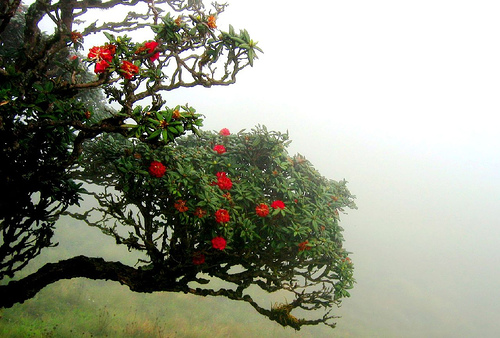
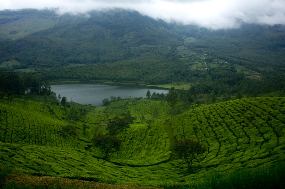
Meesapulimala is the third highest peak in the Western Ghats after Anamudi and Mannamalai. Scaling this peak is a journey of trekking through eight hills, passing through the shared border of Tamil Nadu and Kerala. Here, you can view hundreds of rhododendrons, charming tea estates and gurgling brooks. Peace is easy to find at this 8661 ft high peak in the Idukki district of Kerala.
It is about a 8km trek from Rhodovalley through high altitude grasslands, rainforests and wildlife. The Meesapulima Peak is called so because it apparently resembles a tiger’s face, although you’re not likely to spot any tiger here. “Meesa,” means moustache, “puli,” means tiger and “mala,” means hill. Hence, it is from this that the peak gets its name from and this is why it is called so.
This is just a day’s trek and hence trekkers of any age can go for this trek. There are plenty scenic spot in this trek that trekkers can enjoy and capture. It is a easy to moderate trek and therefore can be completed without any hindrances.

The treks here and the stays are managed by the Kerala Forest Department. You take a permission letter from there and also get a local guide to help you through the journey.
The trek starts at the Silent Valley base camp, which is some distance from the Echo Point. There you are put up at the Sky Cottage. This stretch of the road to the Silent Valley Base Camp is not in the best of the conditions, generally only 4×4 vehicles are allowed. Bikes are allowed too. All around at the there are unending layers of hills, beautiful waterfalls, thick tropical vegetation and the sky up above. The temperature here could considerably low, carrying something warm is generally advisable.
The trek begins early in the morning. From the base camp, one makes their way to the Rhodo Valley. After you cross the Rhodo Valley, one reaches the base of a mountain and the Meesapuliamala is behind this mountain. We climb this mountain up, and one can see the giant Meesapulimala peak from there. Then there is one more valley to cross after which you reach the base of the Meesapulimala. From there it is a straight climb to the top of the peak.
Once on top, one can see the breathtaking Kolukkumalai hills, Yelapetty, Top station, Kurangini and so many other hills.

The way down from the peak is not so easy, but not so difficult either. One more mountain needs to be crossed, after which the descend starts. On way, there are hills covered entirely with Neelakurinjini plants, which looks mindblowing beautiful when it blooms.
The Meesapulimala trek is generally not recommended for the untrained and the first timers. It takes a lot of stamina, and it is not so easy. The Yellapetty trek is even tougher than the Meesapulimala.

